


- National
- Lead News
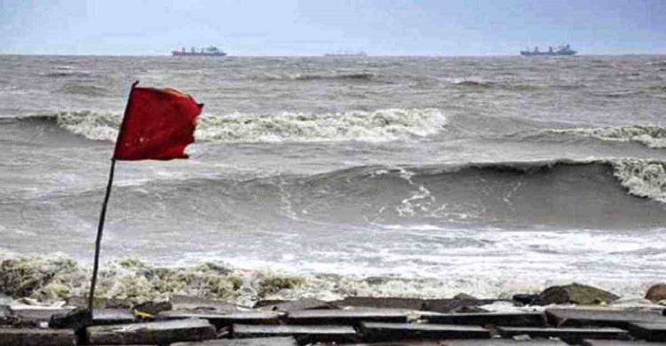
The low pressure has turned into a pronounced low pressure, warning signal number 1 in seaports
- National
- Lead News
- 24 May, 2024 11:58:03
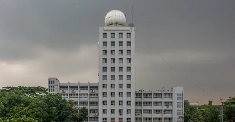
File Photo
News desk: From West Central and Southwest Bay of Bengal, the clear low pressure has taken the form of low pressure in East Central and West Central Bay of Bengal. A number one warning signal is said to be observed in seaports. On Friday morning, the Department of Meteorology, in a special notification number 1, said that the maximum continuous wind speed is 40 km per hour within 44 km of the low pressure center.
Shamim Hasan, deputy director of the storm warning center of the Meteorological Department, said that Chittagong, Cox's Bazar, Mongla, Payra seaports have been asked to watch the number one remote warning signal. Besides, we have asked the fishing boats in the sea to come closer to the coast. Because even if the low pressure does not develop into a cyclone, the sea is still rough. He further said that if the depression develops into a cyclone, it may cross the Sundarbans, Khulna and adjoining Kolkata, West Bengal regions of Bangladesh.
The storm is expected to hit on May 26. But it cannot be confirmed yet. Chittagong, Cox's Bazar, Mongla and Payra barrages have been asked to display remote warning signal No. Besides, all fishing trawlers operating in North Bay of Bengal and deep sea have been asked to proceed cautiously from near the coast till further instructions. At 6 am today, the depression was located 870 km from Chittagong sea port and 805 km south-southwest from Cox's Bazar sea port and 825 km from Mongla and 790 km from Payra sea port. Meteorologists feel that it may intensify further towards the northeast.

11 Iran Sanctions Against US Officials
1
International Desk: Iran has imposed sanctions against at...

The UK general election is today
2
International Desk: Voters are waiting to vote in the UK ...
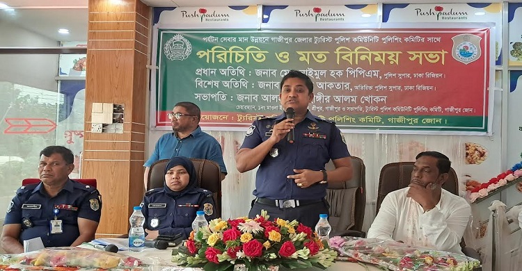
Discussion meeting with Tourist Police Community Policing Committee to improve the quality of tourism services in Gazipur
3
Sreepur (Gazipur) representative: An introduct...
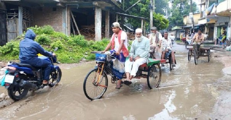
Bad condition of the main road of Chatmohar municipality, public suffering is extreme!
4
Pabna Correspondent: Bad condition of the main...


Comment ( 0)